Crowdsourcing helps mitigate disasters
By ITU News
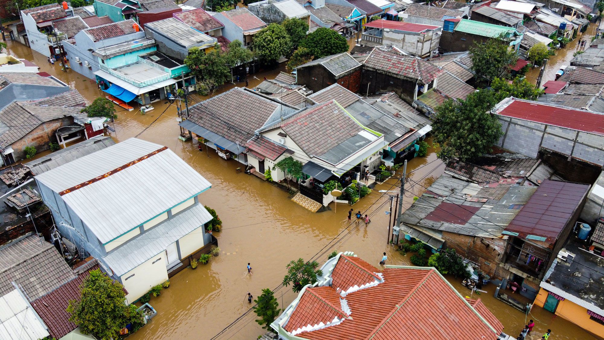
When a disaster strikes Indonesia, residents may well log onto social media before taking shelter.
Posts tagging the PetaBencana initiative with a reference to the disaster – be it due to a flood, earthquake, or volcanic eruption – will prompt a chatbot to appear with a link to the PetaBencana platform. Users can then share their location, photos of any visible damage, and details like flood depth.
Indonesian government agencies then validate these crowdsourced situation reports, using the data to coordinate emergency response measures. Residents can also consult the resulting collaborative map in real time to make informed decisions about their safety and security.
Run by Jakarta-based non-profit Yayasan Peta Bencana (Disaster Map Foundation), the PetaBencana.id platform provides a free, transparent emergency response and disaster management system for cities across South and Southeast Asia.
It relies on low-intensity communications networks – the most that may be available in areas affected by natural disasters – using any mobile phone with Internet access, said Nashin Mahtani, Director at Yayasan Peta Bencana.
Signals from the noise
Indonesia is among the world’s most active countries in terms of Twitter usage. PetaBencana’s creators observed people tweeting about the situation in their communities during raging floods.
But to be truly valuable, such information needs to be properly channelled, with individual posts scattered across social media being converted to on-the-ground reports validated by professionals.
“It’s a process of both verification and structuring crowdsourced data – turning all that noise into useful information through a chatbot,” Mahtani said.
Torrential rains in Jakarta in January 2020 served as a litmus test for the game-changing coordination platform.
Thousands of users turned to the PetaBencana chatbot to report rising water levels and other disruptions. The resulting map was consulted more than 259,000 times during the peak phase of the flooding that ravaged the capital, according to Twitter.
Recent years have seen the platform expand its open-source map to include earthquakes, forest fires, and volcanic eruptions, also frequent in Indonesia.
Context matters
According to the 2021 World Risk Report, Indonesia ranks 38th out of 181 countries in terms of disaster vulnerability.
PetaBencana is just one example of how crowdsourced data and artificial intelligence (AI) can provide crucial context for disaster management teams.
During an AI for Good webinar held earlier this year, experts highlighted how creating effective tech-based responses to extreme natural events requires understanding the context in which they happen as well as the habits of communities that could be affected.
The Focus Group on AI for Natural Disaster Management, which organized the discussion, is a joint initiative of the International Telecommunication Union (ITU), the World Meteorological Organization (WMO), and the United Nations Environment Programme (UNEP).
“To get value for people, we don’t need just to understand what weather is going to do, but what the weather is going to do to the people and to the environment,” said Anthony Rea, Director of the Infrastructure Department at WMO. “This is impact-based forecasting, where AI can play a huge role.”
Engaging vulnerable areas
Torrential rains are also a recurrent problem in Brazil, especially in low-income urban areas or favelas, where poorly constructed buildings heighten flood risks.
Insufficient data on rainfall and especially on its effects on these areas makes flooding hard to predict.
Enter the Waterproofing Data Project, initiated by local authorities and universities. Researchers trained young students about flood risks and resilience, showing them how to make rain gauges out of plastic bottles and collect rainfall data for their communities.
The project’s mobile application, launched this year, has already been tested in schools and with civil protection professionals in nine Brazilian cities. People can send data on neighbourhood flooding and also receive key safety information from local and national authorities, including the Brazilian National Centre for Disaster Monitoring and Early Warning (Cemaden).
According to project managers, the data collected can be used to create more accurate predictive models for flood forecasting.
Smartphones vs earthquakes
A decade ago, University of Bergamo statistics professor Francesco Finazzi began researching how to create an earthquake early warning system that does not rely on seismometers.
The Earthquake Network project and its mobile app use the accelerometers in smartphones to detect initial tremors, sending an alert to people in the affected area to take shelter. Because phone data travels faster than seismic waves, users with the app installed can receive the alert in time to take protective measures and warn others.
The network’s effectiveness depends on having a large enough number of users.
The Earthquake Network’s largest user base is in Latin American countries, including earthquake-prone Chile, Ecuador, Mexico, and Peru. Since its launch, the system has detected more than 4,500 earthquakes around the world, including in the United States, Italy, and Japan.
A recent study following a 8.0 magnitude quake in Peru found that most users perceived the system as useful, in part because it allowed them to prepare mentally for tremors. Many alerted family members.
Still, only a minority took protective action.
System designers will need to keep working with national authorities to ensure early warning services reach everyone, everywhere and that the public knows how to respond to an alert.
Integrating AI
The ITU-WMO-UNEP focus group is working towards international standards and guidelines on data collection and handling; the training, testing and implementation of AI-based models; and the integration of AI into emergency communications and tools.
“The impact of natural disasters is exacerbated in certain regions, such as small island developing states and least developed countries, and for certain populations such as women and children,” notes focus group chair Monique Kuglitsch.
As climate change unfolds worldwide, disaster impact “is expected to worsen,” she adds.
The ITU-WMO-UNEP Focus Group on AI for Natural Disaster Management is exploring the potential and limitations of using AI to improve our understanding of natural hazards and better predict, detect, and communicate impending or ongoing disasters. To find out more, visit the group’s website and register for its next meeting and workshop in Athens, Greece, 24-26 October 2022.
Image credit: syahrir/stock.adobe.com