Earth exploration-satellite services in disaster response management

Joanne Frolek, Engineer, Space Utilization, Canadian Space Agency
Not a day goes by without some disaster affecting people or ecosystems. Tornados, floods, landsides, forest fires, and even oil spills — are disasters that often cause extensive damage.
Satellites operating in the Earth exploration-satellite service (EESS) provide invaluable and immeasurable assistance to disaster-response organizations, helping them respond effectively and efficiently to save lives, assist in restoration, and protect critical infrastructure, ecosystems and property.
The International Charter “Space and Major Disasters”
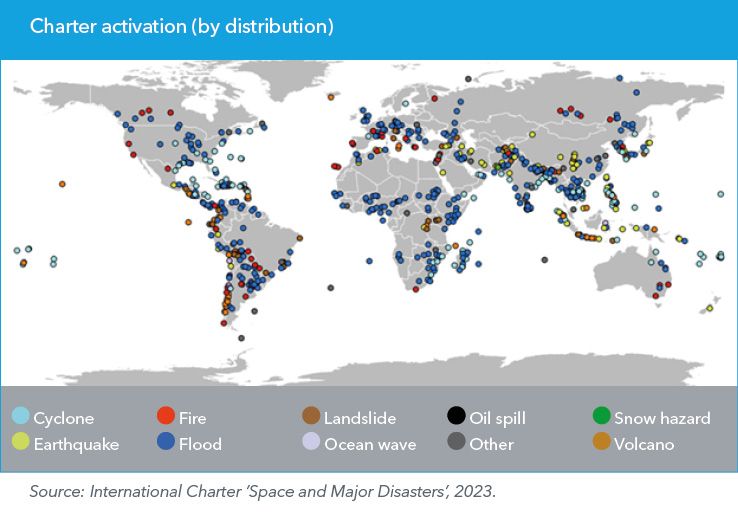
Over 20 years ago, space agencies around the world created the International Charter ’Space and Major Disasters’. A collaboration between various space agencies and commercial satellite operators, the Charter allows national disaster management authorities in any country to request free satellite imaging to aid in disaster response.
Satellite sensors — different images for different purposes
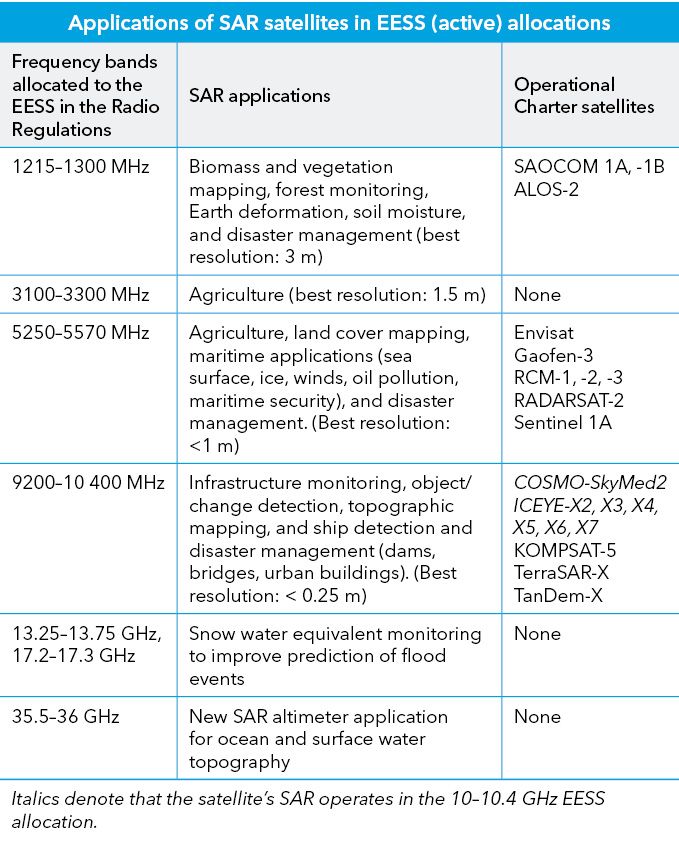
The operators of the Charter determine the best satellites and sensor solutions to provide the most useful data based on a given disaster. Sensors operating at low frequencies provide better penetration into vegetation and are useful when a disaster occurs within vegetated areas. Sensors operating at high frequencies benefit from a larger available bandwidth and can provide better resolution images, like identifying damage to infrastructure.
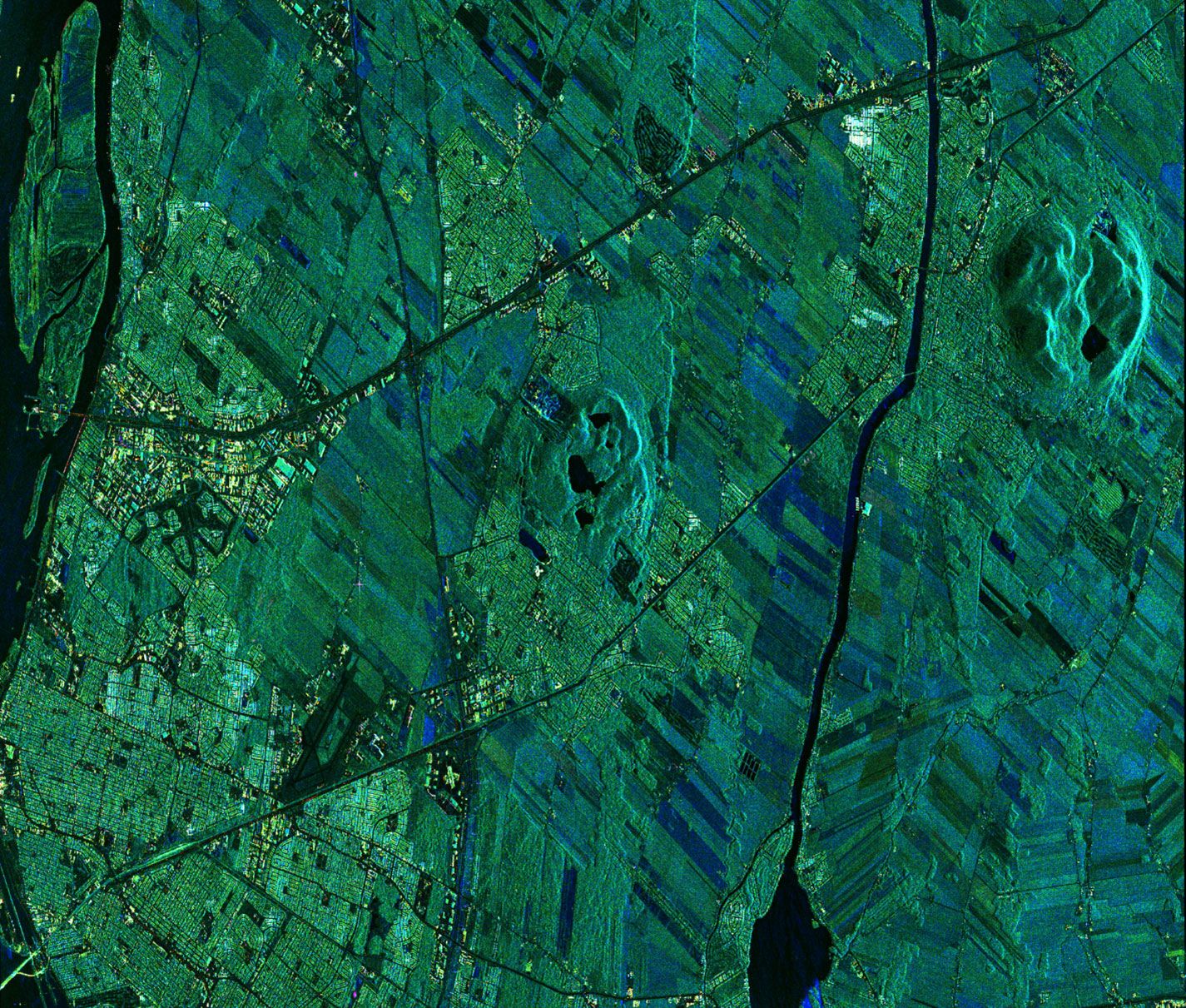
Unlike optical sensors, synthetic aperture radar (SAR) sensors, with reduced latency, are unaffected by nighttime or clouds.
This makes them highly effective in addressing key hazards like floods, oil spills, and landslides.
Different allocations for different types of EESS applications
Optical sensors do not currently require radio-spectrum allocations to operate, and infrared sensors are not allocated in the Table of Frequency Allocations maintained by the International Telecommunication Union (ITU). However, SAR sensors do require radio-spectrum allocations.
The table lists some SAR applications operating in different frequency bands along with some Charter satellites that operate in those bands.
Ensure spectrum availability
A potential new mobile service allocation and International Mobile Telecommunications (IMT) identification in 10–10.5 GHz in the Americas (Region2) is an agenda item for the upcoming World Radiocommunication Conference, WRC‑23. This is of high importance to the disaster-management community, given the potential for harmful interference into the EESS systems providing important imaging to the global community.
A previous WRC, in 2015, expanded the original EESS (active) allocation, recognizing the need for higher resolution data that the extension of the band allows. The allocation is valuable in situations where high-resolution data is needed over a localized area and weather conditions and the time of day prevent the use of optical sensors.
The high resolution offered by the 10 GHz band is advantageous in determining infrastructure damage in cities. At the same time, images and data from those urban areas would be most at risk from IMT deployments. Compromise on the existing use of the 10 GHz band could lead to erroneous and misinterpreted data, resulting in the loss of crucial information required for timely decision-making in disaster response.
To avoid major impacts to the EESS user community, all Earth-observation stakeholders need to ensure that satellite sensors can operate in this frequency band and other bands without interference. Failure to protect the EESS allocations would lower the quality of satellite images for disaster response efforts, undermining the International Charter and the EESS user community.
Download your copy of the ITU News Magazine: Science services.
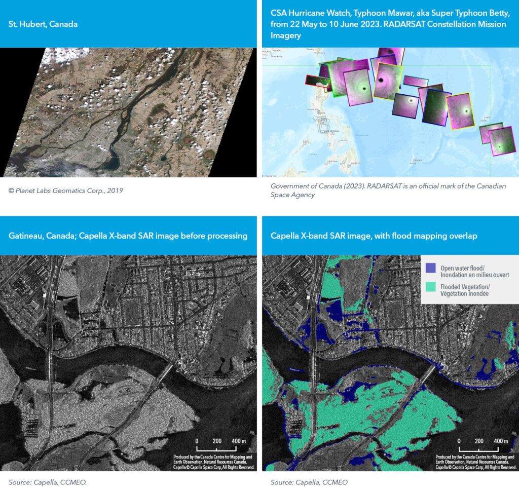
Header image credit: © Government of Canada (2023), RADARSAT is an official mark of the Canadian Space Agency
Header image caption: St. Hubert, Canada. RADARSAT Constellation Mission Imagery.