Copernicus: Using Earth observation to achieve the Sustainable Development Goals
From the earliest times, humans have dreamed of flying like birds — looking down from high above, to the ground below.
Prehistoric civilizations are unlikely to have even imagined powered flight, or cameras that can record the world around us. Even 100 years ago, with flight and photography relatively common, the idea of “taking pictures” of the Earth from space was unheard of.
How we view the Earth today with satellites
Today, if you ask the average person about satellites looking at the Earth, the majority will tell you about spy satellites taking pictures of secret bases. While this is still done by dedicated satellites and was indeed the precursor of modern Earth-observation (EO) satellites, now scientists prefer to view the Earth with a much wider spectrum of radio colours, far beyond the senses of any living thing.
Traditional optical images provide limited information about the world; most of the useful characteristics can only be seen through radio frequencies — things like soil moisture, CO2 densities, water levels, atmospheric particulate concentrations, and more.
A variety of different sensors are fitted to EO satellites, often taking advantage of particular natural phenomena, such as the absorption frequency of water vapour just below 24 GHz. This is a particularly useful frequency to monitor as it tells us the moisture content of the atmosphere, which helps to model and predict the build-up of storms and tropical cyclones. Water vapour is also a key greenhouse gas.
Measurements are done passively, looking at the infinitesimal interactions of those little water molecules as they do their rain dance around 24 GHz.
This makes it imperative to keep that frequency free from interference, or the measurements will become degraded, or impossible to make. To help achieve this, the frequency range is listed as a passive band in the Radio Regulations; no emissions are allowed and out-of-band interference has to be minimized.
The World Radiocommunication Conference 2023 (WRC‑23) agenda includes several items that could affect EO satellite measurements and so regulators will need to weigh up the benefits and implications of any proposed regulatory changes, especially where International Mobile Telecommunications (IMT) is considered for operation next to an Earth exploration-satellite service (EESS) allocation, and even more so when it is passive.
The Copernicus system
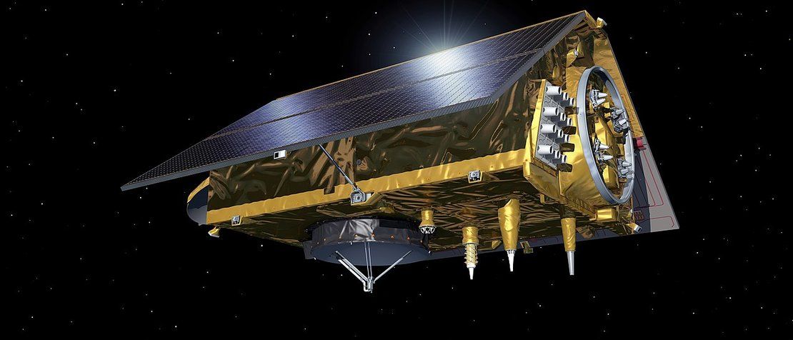
The European Union’s Copernicus system is an Earth-observation system that looks at 24 GHz — but that is just one of the many instruments fitted to its satellites. As of January 2021, Copernicus has eight Sentinel satellites in orbit and each type is fitted with a different range of sensors to monitor different aspects of the Earth (using active and passive Earth exploration-satellite service allocations from 5 GHz through to 37 GHz, with future plans to use frequencies in the L-band). And yes, some satellites do include optical imaging, at around 10–20 m and 300 m resolutions. The eighth Copernicus satellite was launched in November 2020.
Named in honour of trailblazing former Director of the United States National Aeronautics and Space Administration (NASA) Earth Science Division, who passed away in August 2020, “Sentinel-6 Michael Freilich” measures sea-level changes with high accuracy.
Copernicus is not just composed of the European Union’s Sentinel satellites; it is a system of systems, collecting data from a variety of other contributing Earth-observation space missions from around the world, as well as ground infrastructure. Through arrangements these systems get direct, full, free and open access to Copernicus data (16 TB per day) that adds to their own data. Copernicus in turn benefits from having access to their sensor data, thereby expanding its service coverage and reliability.
Yes, for free: as in gratis, zilch, nada.The various data sets are then woven into a portfolio of six services that are offered to the world free of charge.
Six thematic service areas
The services address six thematic areas: land, marine, atmosphere, climate change, emergency management, and security. They support a wide range of applications, including environment protection, management of urban areas, regional and local planning, agriculture, forestry, fisheries, health, transport, climate change, sustainable development, civil protection, and tourism.
When disaster strikes, the Copernicus Emergency Management Service (EMS) can be activated by countries responding to natural disasters, human-made emergency situations or humanitarian crises.
This triggers a whole host of extra data that can be provided to help responding organizations get the best possible picture of the events as they unfold. Today, more than 400 activations have occurred across the globe, in developing and developed nations.
Data: Crucial to achieving the SDGs
Copernicus data are also integrated by third parties into many things we see and take for granted, such as TV and Internet weather forecasts, and are also a crucial tool in helping to achieve the Sustainable Development Goals (SDGs).
Data from Earth-observation satellites play a key role in most of the seventeen SDGs to help monitor targets, plan and track progress, and help countries and organizations make well-informed decisions as they work towards SDG objectives.
Various international bodies such as the Group on Earth Observations (GEO) and the Committee on Earth Observation Satellites (CEOS) have been set up to promote and coordinate the uptake of Earth-observation techniques that support environmental policies and improve daily life on our planet.
Countering the COVID‑19 crisis
To help counter the ongoing COVID‑19 crisis, Copernicus has provided data to assist GEO and CEOS efforts to better understand and react to the situation, and the European Commission and the European Space Agency (ESA) have also jointly developed “Rapid Action on COVID‑19”. The COVID‑19 Earth Observing Dashboard is an effort between ESA, Japan Aerospace Exploration Agency (JAXA) and NASA.
In addition, the European Commission, its partners and members of the Copernicus ecosystem have established a dedicated EU Space webpage that gathers their various initiatives. Copernicus is coordinated and managed by the European Commission, working in partnership with the European Union (EU) Member States, ESA, the European Organization for the Exploitation of Meteorological Satellites (EUMETSAT), the European Centre for Medium- Range Weather Forecasts (ECMWF), EU agencies and Mercator Ocean.
Watch the COVID-19 Earth Observing Dashboard tutorial video here.
Learn more about Copernicus here.
Image credit: European Space Agency via Wikimedia Commons