Argus Quick Guide
Table of Contents
Introduction
Important Concepts
Available soon
Important Definitions
Available soon
Quick Start
Scenario
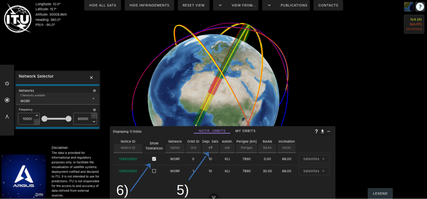
We want to display all orbits of a network. Then display the orbits of the satellites deployed in this constellation. After that show only orbits where the tolerances of Resolution 8 have not been met and finally display the tolerances for this orbit and visually inspect the orbits.
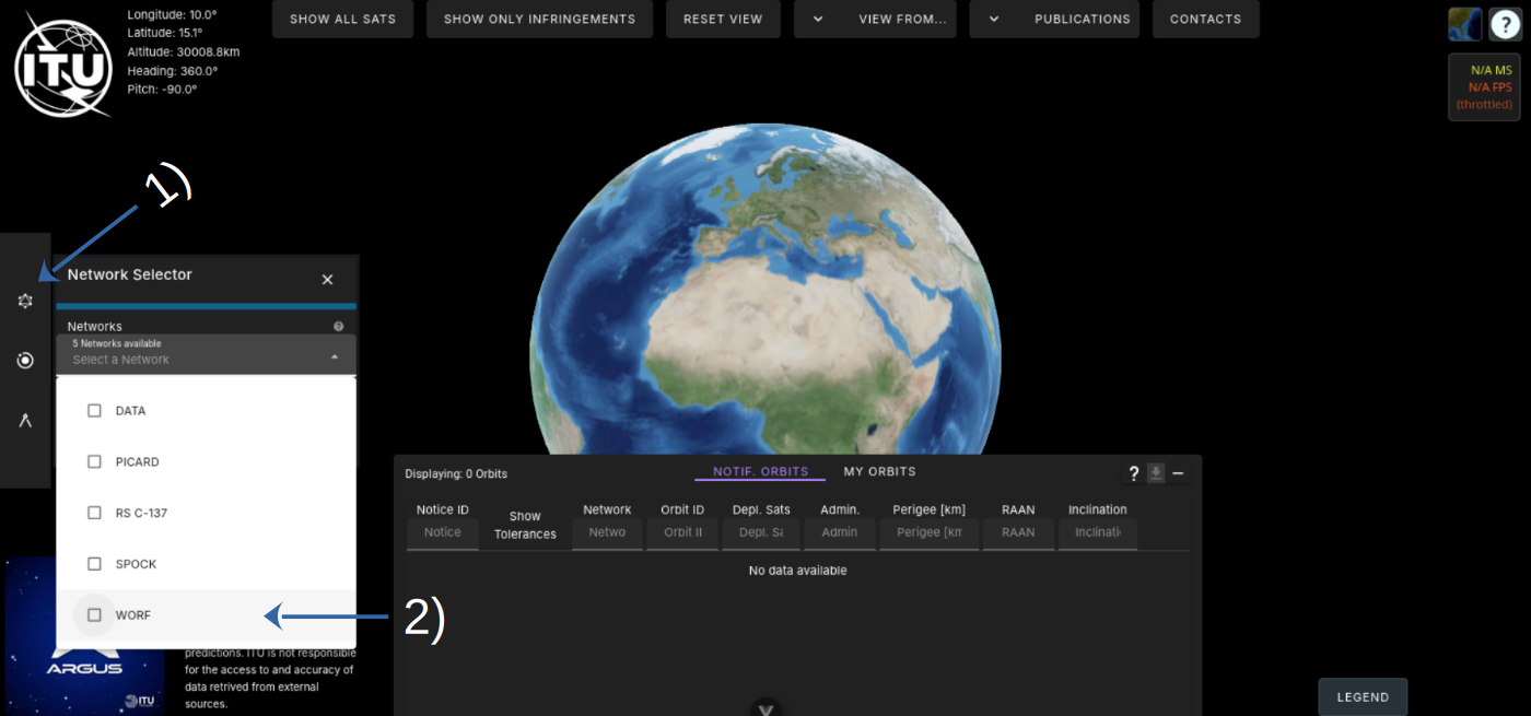
2) Select Network WORF
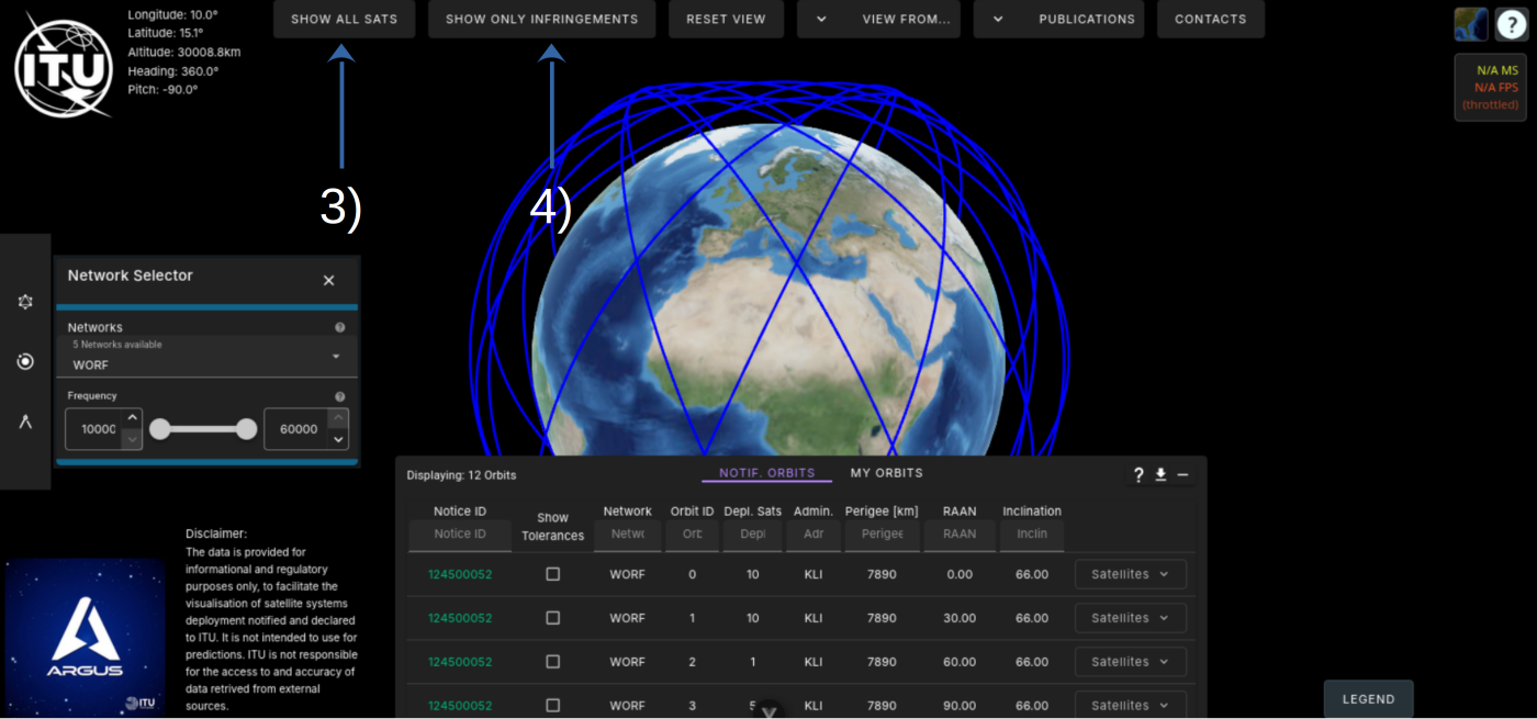
4) Show infringing orbits only
6) Switch on a tolerance display
It is visible that this orbit is not within the ±30km tolerance.
Argus Interface
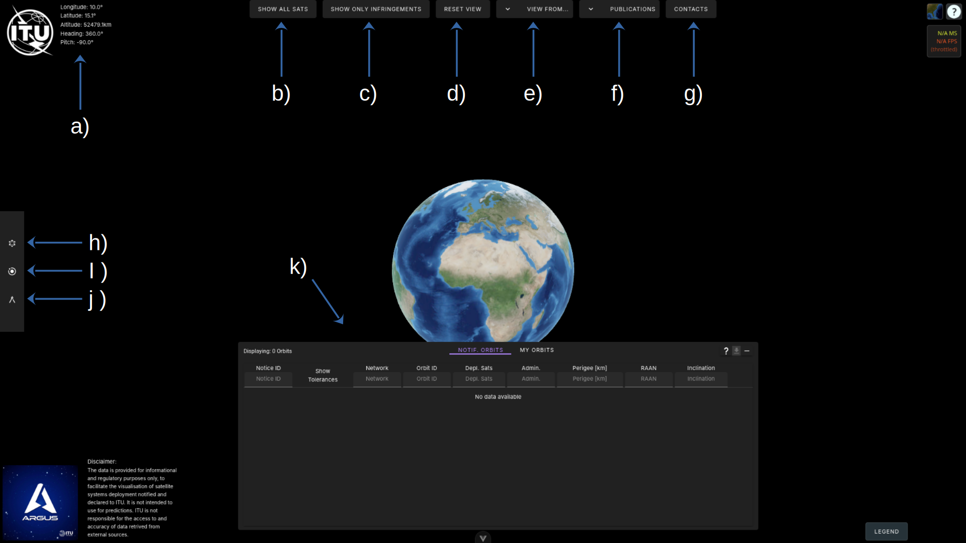
Control Elements Description
| Element | Description |
|---|---|
| a) | Headup Display – Shows the position altitude, and, orientation of the camera in reference to the surface. |
| b) | Toggle Satellite Filter – Toggles display satellite orbits if any satellites belong to the network. Default: Not displayed. |
| c) | Toggle Infringement Filter – When activated, shows only orbits where at least one satellite does not fulfill the Resolution 8 tolerances. Default: All orbits are displayed. |
| d) | Reset Camera View – Resets the camera position and pitch to the home position. Very helpful. |
| e) | View from – Positions the camera on the surface of the earth at the provided coordinates. Coordinates are given in degrees longitude and latitude. Can be used to view satellite constellations from the surface. |
| f) | Publications – Links to the ITU-R Publications of Resolution 8 and 35. |
| g) | Contacts – Opents the contacts widget with a collection of points of contacts for each system. |
| h) | Network Selector – Choose at least one or more networks to display their constellations’ orbits. The list can be narrowed down with a frequency filter. |
| i) | Orbit Filter – Displayed orbits can be interactively shown or hidden, based on the selected filters. |
| j) | Orbit Planner – Create your own orbits based on perigee, apogee, inclination, and right ascention node. |
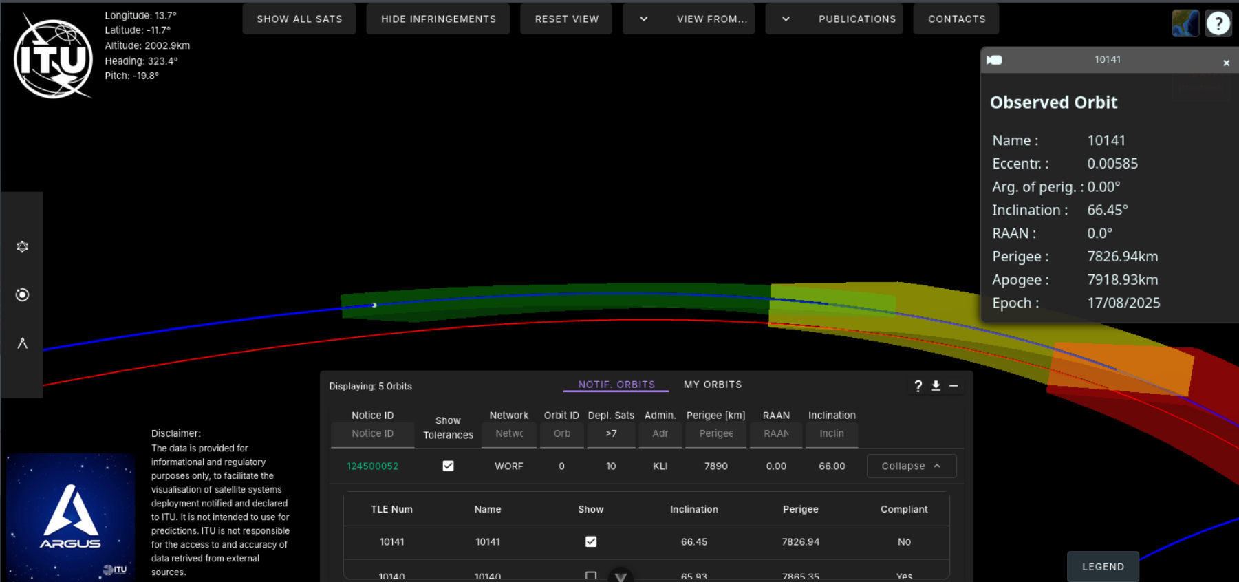
| k) | Detail Display – Provides further information on shown orbits and can be searched in each column. Exp: Enter “>7” (without quotes) in Depl. Sats to display all orbits of the currently selected networks that have more than 7 satellites deployed. |
