
Bridging infrastructure gaps to accelerate school connectivity
Data and infrastructure mapping is essential to accelerating school connectivity; it helps governments and relevant stakeholders to identify connectivity gaps – and fill them.
As part of the Capacity development to accelerate school connectivity project, a face-to-face Infrastructure Mapping for School Connectivity training was held in Geneva, Switzerland, earlier this year. It enhanced participants’ theoretical and practical skills in collecting ICT infrastructure data, identifying underserved areas, applying Geographic Information System (GIS) tools, and using connectivity models to evaluate and compare various connectivity scenarios.
Participants gained hands-on experience, focusing on key methodologies for data standardization, infrastructure modelling and decision-making processes that support effective and sustainable school connectivity.
“Through the hands-on experience at the workshop, I realized GIS’ potential as a decision-making tool that allows for precise identification of underserved areas and more strategic broadband expansion,” said Sheikh Sheriff, Chief Information Officer from the Ministry of Post & Telecommunications, Republic of Liberia. “Since returning to Liberia, I have engaged with key institutions and relevant government agencies to apply the insights I gained from the training. Liberia still faces significant digital access challenges, particularly in rural schools and underserved regions. With GIS, we can map these areas accurately, prioritize investments, and optimize broadband deployment strategies. This will help accelerate efforts to connect schools, improve access to digital learning, and promote digital inclusion across the country. Overall, GIS has the potential to transform how Liberia approaches digital infrastructure development, and I am excited to continue driving this agenda forward.”


Sharing their new skills with national stakeholders, participants anticipate amplifying the impact of the training to help bridge the connectivity gap and enhance students’ opportunities.
“I want to ensure that the GIS skills and insights I gained from this workshop benefit not just me, but also my colleagues and stakeholders involved in ICT infrastructure planning,” said Sahra Ramdath, Digital Transformation Analyst, Digital Policy, Strategy and Research Unit, Ministry of Digital Transformation, Republic of Trinidad and Tobago. “Better planning will lead to more efficient infrastructure investments. By transferring my new GIS knowledge to others, I can help to create more informed and skilled employees, capable of continuously improving digital infrastructure planning. In the long run, this will help bridge the digital divide, providing students and teachers with better access to online resources and learning opportunities and also increase connectivity within the country at large.”
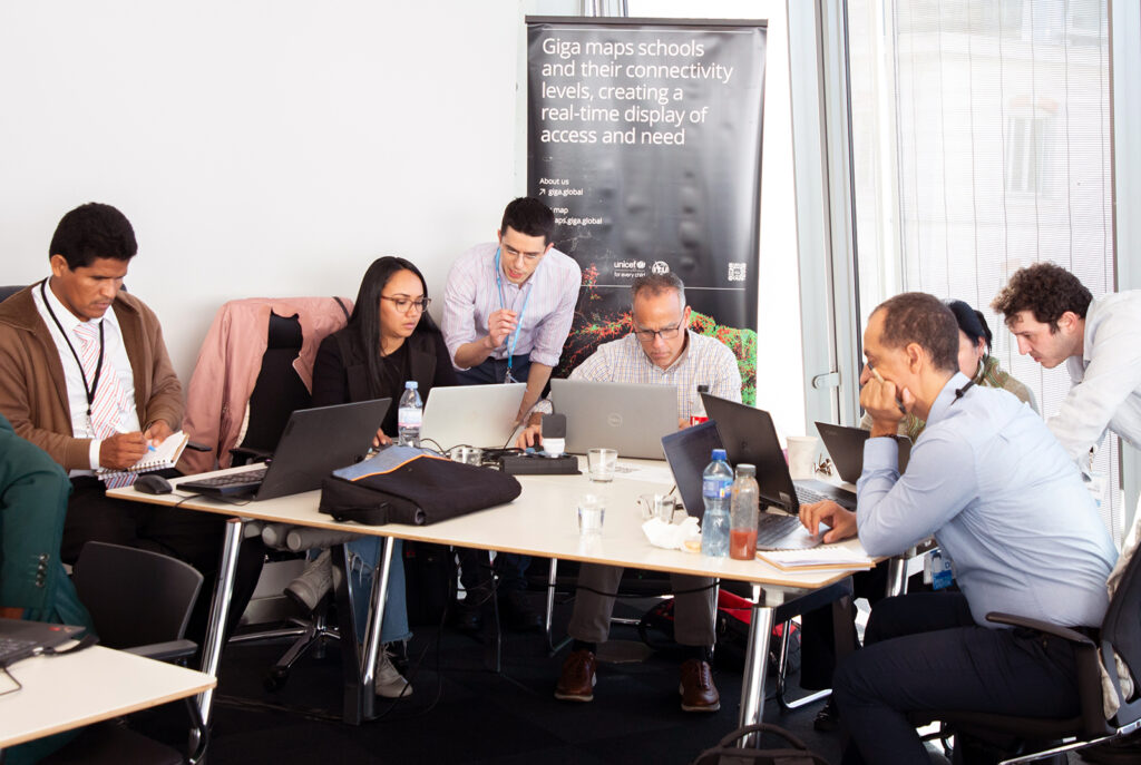

A hands-on training course on Applied Geospatial Tools for School Connectivity also took place to equip participants with practical skills in Quantum Geographic Information System (QGIS) and Python to address real-world school connectivity challenges. Participants engaged in sourcing and extracting open data on ICT infrastructure and amenities, working in groups to solve connectivity problems using actual school connectivity datasets.
Contributing to school connectivity and mapping
In addition to delivering training programmes that aim to enhance the theoretical and practical skills needed for effective school connectivity planning, the work of the Telecommunication Development Bureau to help bridge the gaps to school connectivity – such as insufficient bandwidth, network security, infrastructure gaps, funding and technical support – includes:
- Working with governments, service providers, and other stakeholders to coordinate efforts and leverage innovative financing mechanisms to support school connectivity projects.
- Conducting infrastructure mapping and connectivity analysis to evaluate the connectivity status of schools and explore potential connection alternatives.
- Mapping the location of schools and monitoring their connectivity status in real-time. This involves collecting and analysing data on school connectivity to identify gaps and prioritize areas for intervention.
This is an ITU Development #DigitalImpactUnlocked story
About the project
The project, Capacity development to accelerate school connectivity in collaboration with the Giga Initiative, aims to strengthen the capacity of ITU Member States and relevant stakeholders by enhancing their telecommunication/ICT policy, legal and regulatory knowledge and frameworks to accelerate school connectivity and to connect young people to digital technologies and services.