
Page 158 - Proceedings of the 2018 ITU Kaleidoscope
P. 158
2018 ITU Kaleidoscope Academic Conference
periodic images but with the great disadvantage that they
have low resolution, which makes them useless for
identifying patterns in small buildings. Companies like
DigitalGlobe offer images of very good resolution, but at a
high cost. Due to the nature of the project, the volume
required is very high as well as the cost to obtain them. It
would be almost impossible to face both situations
considering the academic nature of this project.
A consortium of companies including DigitalGlobe,
CosmiQ Works and NVIDIA launched SpaceNet [10] in
2016, an online repository of satellite images and co-
registered map data to train algorithms. It is a corpus of
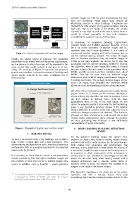
Figure 3 – Flow of input data until its final output commercial satellite imagery and labeled training data to
use for machine learning research. The corpus of images
Finally, the wanted output is achieved. The remaining with an excellent resolution (they are satellite images of
details have to do simply with non-functional requirements, 0.3m), is not only available for access, but it also has
such as the way in which the output will be presented to the geolocated labels to delimit buildings, perfect for training
users so that they could evaluate it and give it, or not, the algorithm. What is even better, the corpus is divided
utility. The mockup in Figure 4 represents the proposed into two volumes: the first, aimed to train algorithms -about
graphic user interface. It shows the number of buildings and 40GB-, and the second, to perform validation tests -about
square meters detected in the same coordinates but at 20GB-. Last but not least, there are different image
different times alternatives, such as RGB images, panchromatic images or
8 multispectral bands. The package includes images of four
cities: Las Vegas, Paris, Shanghai and Khartoum, which
allows us to test the algorithm in various urban structures.
All of the above represents an almost perfect combo for the
project needs. It is almost perfect because although it
allows training the algorithm and tests its accuracy it does
not have images at different times from the same
geographical place so that, in the final output, we can
obtain the expected results. That is why, for the final testing
stage, it was decided to generate changes in the satellite
images artificially to visualize in the final output the way in
which the changes produced are detected. This decision,
although not ideal, allowed us to continue with the project
without major consequences since, although the scenario
we were generating was fictitious, it was sufficiently
representative of reality to be useful.
Figure 4 –Example of graphic user interface model. 4. DEEP LEARNING BUILDING DETECTION
MODEL
3. DATASET DETAIL
For the detection building model, two options were
To have a successful result, a big challenge was to find a possible: to create a new model or reusing models already
large volume of input data with a high resolution. This evaluated and with a useful function for the project scope.
allows training the algorithm in such a way that a parameter Both options have advantages and disadvantages. For
configuration with an acceptable precision for the expected example, lacking experience in these issues, the making of
ranges could be obtained. a new model, implied to start down on the learning curve. It
is necessary to check continuously if the architecture is
It is necessary to know that the search is not particularly correct and, if not, proceeds to accordingly correct the
simple, considering that the higher resolution images are errors. On the other hand, when reusing models with a
not available for free. Free access to satellite images only checked architecture and a solution within limits of
1
occurs in satellites such as LandSat , which generates tolerable errors is good, but implies this solution to be
adapted to the needs of the present project.
The SpaceNet algorithms [11] which are in the public
1 The Landsat Program is a series of Earth-observing satellites repository and with a free-use license were used
co-managed by USGS & NASA and offers the longest considering that it was the most appropriate solution for this
continuous space-based record of Earth's surface.
– 142 –