
Page 42 - Implementing ITU-T International Standards to Shape Smart Sustainable Cities: The Case of Singapore
P. 42
Implementing ITU-T International Standards to Shape Smart Sustainable Cities –
The Case of Singapore
Urban planning has a significant and long-term impact on how a city functions, and on its long-
term sustainability. Poorly designed cities that focus only on private automobiles are usually
inherently less sustainable and less resilient with their dependency on low-cost fossil fuels. It is
also noted that cities lacking green spaces tend to have poorer air quality due to the lack of
natural air filtration and cooling effect provided by green areas and trees. In response to these
factors, Singapore’s Urban Redevelopment Authority (URA) uses a smart information technology
system to help its urban planners develop and implement plans for building a smarter and more
sustainable nation. They use geospatial and real-time data for planning and development, to
understand demographics for social services, and to map vehicular and pedestrian flows. These
data are publicly available via the government’s data-sharing portal, applications and other
online sources.
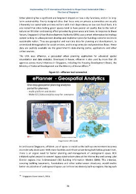
The URA uses ePlanner, a geospatial urban planning application for advanced spatial
visualization and data analytics. Developed in-house, ePlanner is also used by more than 25
agencies across many initiatives in Singapore, including the Housing Development Board, the
30
Ministry of National Development and the Ministry of Home Affairs.
Figure 13 – ePlanner tool screenshot
Image Source: URA (Quek)
In land-scarce Singapore, efficient use of space is crucial as the built-up environment becomes
more densely developed. With more facilities and infrastructure being built below ground level,
there is an urgent need for better planning and management of underground space. BCA
initiated a pilot project to convert legacy substructure plans at the Marina Bay and Jurong Lake
District regions into 3-dimensional (3D) Building Information Models (BIM). This initiative,
covering building basements, foundations and other subterranean structures, would enable
better visualization of underground space use in these two densely built-up regions. Having such
30
Singapore Government, 2016.
32