Page 529 - Shaping smarter and more sustainable cities - Striving for sustainable development goals
P. 529
applications in various sectors (e.g. natural resources, utilities, transportation, public safety and
            defence). Their integration can improve data management especially of large volume projects, since
            they  provide  high  quality  results'  display  (particularly  in  hydraulic  simulation  modelling),  thus
            enabling additional analysis to inform decision‐making.
            GIS  allows  visualization  and  analysis  of  water  resources  and  human  activity  data  by  linking
            geographic  information  with  descriptive  information.  This  is  highly  valuable  to  urban  water
            management in assessing water quality and day‐to‐day operations on a local and regional scale.
            Other issues such as flooding can also be mitigated by the use of geographical information, by
            helping to identify critical areas that are at risk. This is necessary in the development of hazard maps,
            as  well  as  in  the  planning  of  emergency  responses.  GIS  utilization  offers  more  robust  analysis,
            increased efficiency and reduced costs.

            By  integrating  information  from  resource  satellites,  GIS  can  cover  large  river  basins  which  are
            occupied by some cities. Combined with local rainfall patterns, meteorological and hydrological
            data, as well as drainage systems, geographical information and interfaces improves urban storm
            water management by strengthening drainage management and enhancing rainwater reuse, thus
            helping to reduce the prevalence of urban flooding.

            e.      Cloud computing

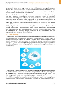
            Cloud computing uses an external computing power ability which is outside the boundary of a user's
            own  infrastructure,  to  run  programs  or  applications.  Cloud  environments  typically  enable  the
            following  functionalities:  monitor  and  manage  computing  without  human  involvement,  broad
            network  access  to  allow  computing  services  to  be  delivered,  access  over  several  networks  and
            heterogeneous devices, technologic ability to scale up or down computational resources swiftly and
            as needed, ability to share across multiple applications, as well as to track applications/tenants for
            billing purposes.


            Cloud systems in urban settings also allow high efficiency and high utilization of pooled resources
            for a better balance of workload and computation through multiple applications, providing urban
            water managers with a wide range of possibilities in computer modelling and data storage. Urban
                                                                                        28
            flood management is another area where cloud computing is increasingly use.
            Beyond their technological interest, various issues like data privacy, security and ownership have to
            be clearly validated by the cities prior to any massive deployment of Cloud computing solutions.


            ITU‐T's Technical Reports and Specifications                                                  519

