-
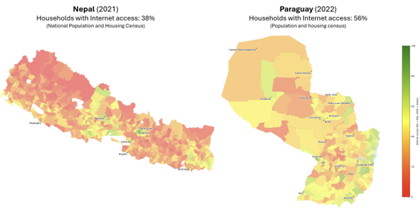
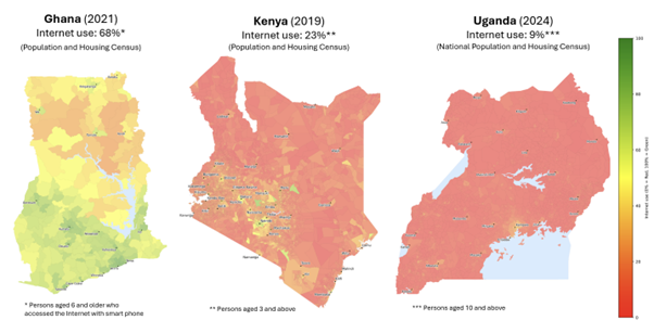
Census data (selected countries)
By combining high-resolution census data from a set of pilot countries with a wide array of open big data sources, including demographics, ICT infrastructure and data derived from satellite imagery, we can estimate internet use at a granular level, down to areas as small as 1 km². We also integrate derived datasets on poverty and income, using both direct and indirect measures. Each dataset is transformed, mapped, and aligned to the same geographic boundaries as the census or survey data, enabling rich, multi-dimensional modelling.
Estimation approach
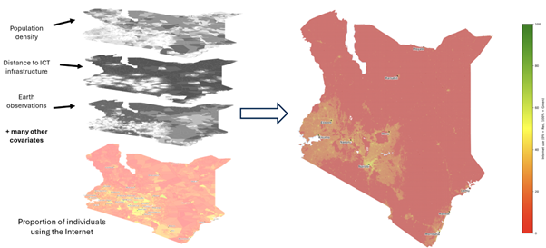
ITU applies a top-down method to ensure the overall number of Internet users in the country match official data. The process has three key steps:
1. Estimate the relationship between Internet use and geospatial big data at the lowest geographic level with actual data from household surveys or censuses, e.g. municipality.
2. Apply the statistical model and predict Internet use for even smaller geographical areas, e.g. postal codes, enumeration areas or standardized tiles.
3. Use the predicted values as a weighting layer to disaggregate the total number of Internet users within each administrative area into the smaller geographic areas.