Despite widespread connectivity, critical gaps remain in reaching vulnerable populations during emergencies. The national coverage statistics tell us that 173 million people (ITU Facts and Figures 2024) live in places where they cannot receive early warning messages, but they cannot tell us specifically where these people are.
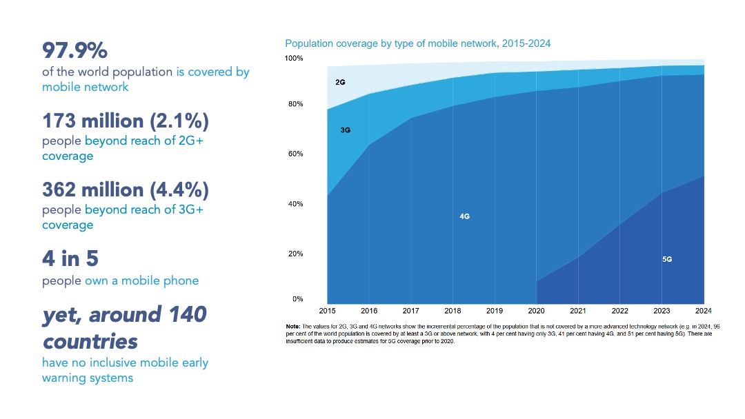 Source: ITU Measuring Digital Development Facts and Figures 2024
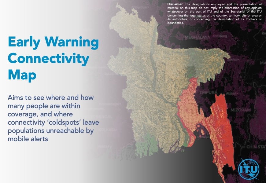
Understanding where people can be reached is essential for effective disaster response. To meet this requirement to be able to reach these people with early warnings, we have developed the Early Warning Connectivity Map (EWCM).
This tool compares high resolution population, coverage and connectivity datasets to produce granular subnational maps and datasets to show where and how many people are within fixed and mobile coverage. On the georgraphical information system mapping side, our specific job for EW4All is to identify connectivity coldspots, that is people not covered by fixed broadband, 2G or 3G+ networks, who cannot therefore receive emergency warnings through these channels.
| 
|
Where does the data come from?
The EWCM uses multiple sources for network infrastructure, cellular coverage, and connectivity measurements that also form part of the the Disaster Connectivity Map framework. These sources include the ITU Transmission Map, GSMA and Collins Bartholomew Ltd cellular coverage maps, OpenCelliD, Meta for Good, Measurement Lab (M-Lab), NetBravo, Ookla for Good, and Speedchecker.
The infrastructure and coverage data has been validated by ITU Member States and supplied by Mobile Network Operators and is then augmented with updated and real-time crowd-sourced connectivity data from a number of data sources.